Friday, June 16, 2006

People Happy, Lawns Not so Much

Tonight and Tomorrow

Lows tonight in the mid 60s city to mid 50s in the cooler 'burbs with comfortable humidity should allow the AC to stay off for another night. Temperatures and humidities will creep up under sunny skies tomorrow with highs 88° to 90&deg.

For the rest of the weekend outlook, see Camden's post below.


Despite some second-guessing in the earlier comments (myself included), temperatures under brilliant blue skies are topping out in the mid 80s in the immediate Washington DC metro area. National dropped back 2° after hitting 85° at 3pm. In the southern fringes of the region, Fredericksburg and Stafford both reached 88°, as did reliably warm Frederick on the northern side.

Those brown spots in your lawn are harbingers of developing drought. Even after Monday's early showers, the accumulated precipitation deficit for the year so far reached 6" today, or 34%. The gains of April and early May have now been virtually wiped out. Slightly under ¾" of rain has fallen in the 4 weeks since May 20, and the prospects in the next week are not looking very good.

CapitalWeather.com chart from NWS data, photo © Kevin Ambrose

Thursday, June 15, 2006

June's Perfection Extended

Tonight and Tomorrow

For tonight, low temperatures under clear skies will be from the low 60s in the city to the low 50s in the cooler 'burbs. Tomorrow will be sunny with low humidity and highs again in the mid 80s.

For the extended outlook, see Josh's post below.


The remnants of Alberto have scooted northeastward to just off Nova Scotia this afternoon. The storm has strengthened as a non-tropical system, prompting the Canadian Meteorological Service to issue marine warnings for portions of the Atlantic Coast.

Despite northwesterly breezes gusting over 20 mph, strong June sun through a mostly clear sky has pushed temperatures in the Washington DC metro area as high as the mid 80s this afternoon. Combined with dewpoints in the mid 40s to low 50s, this has resulted in nearly ideal weather. Expect more of the same tomorrow, except for a little less breeze and a degree or two warmer temperatures.

Photo of last night's sunset from Chantilly VA contributed by Michael Ambrose

Energy Watch

June's comfortable temperatures have helped reduce air conditioning usage, and electric bills in Maryland could be further minimized as a special session of the Maryland legislature late last night approved a bill designed to reduce the 39% Pepco and 72% BGE price increases set to go into effect this summer. The BGE increases will be initially capped at 15%. The online WaPo reports that Gov. Ehrlich expressed disapproval of the bill on WBAL radio this morning.

In other legislative action, the U.S. Senate, having failed to include even the minimal McCain/Lieberman CO2 cap-and-trade proposal in last year's energy bill, is now set to take up legislation limiting outdoor burning.

Wednesday, June 14, 2006

Happy Flag Day

Sandwiched between Alberto's remnant rains and some scattered thundershowers to the north, the Washington DC metro area remains dry but cloudy and cool this afternoon.

Outlook: Tonight and Tomorrow

After a chance of scattered showers or thundershowers this evening, skies will gradually clear tonight with lows in the lower 60's city to some upper 50s in the cooler 'burbs. Tomorrow will be sunny and less humid with highs around 80.

For the outlook through the weekend, see Dan's post below.


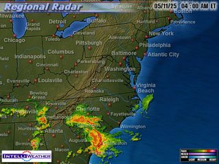
The National Hurricane Center discontinued advisories on Alberto as it became non-tropical this morning, but heavy rains are continuing from the remnants of the storm, and it will probably strengthen as it moves out over the Atlantic tonight. After receiving almost 1½" of rain through early this afternoon, Norfolk collected over 1" more in the hour ending at 4pm and over 2" in the 3 hours just ended. Rain has tapered off at Raleigh after more than 5" fell in the 6 hours ending at 2pm.

Closer to home, cloud ceilings at National, which lowered to 1700 ft. late this morning, are back up to 20,000 ft. Not a drop of rain was recorded, although radar showed some showers reaching almost as far as the southern portions of the Beltway. The persistent clouds have kept temperatures from breaking past 70° so far today. At Afternoon Blog Central in MoCo, some sun is now shining weakly through the overcast.

Radar map at about 3:45pm today from IntelliWeather

Flag Waving

If today's 3 mph winds were not enough to wave your flag, Bethesda inventor Richard Levy has the answer. Today's WaPo reports that the co-creator of Furby has produced a self-waving flag. The product retails for $19.99, batteries included, at Toys R Us, Kmart and CVS.

Tuesday, June 13, 2006

In a Word, Super

With a near-perfect June day in the Washington DC metro area, PM Update was tempted to just phone it in. Temperatures in the upper 70s to low 80s, light variable breezes, and low humidity combined to exhaust the supply of superlatives.

Outlook: Tonight and Tomorrow

Lows tonight will be near 65° in the city, 60° in the cooler 'burbs, with increasing clouds toward morning. Wednesday will be partly to mostly cloudy with a 40% chance of showers, higher chance south of the Beltway, and highs around 80.

For the outlook through the weekend, see Jason's post below.


Tropical Beat


Having made landfall about 50 miles southeast of Tallahassee FL a little after noon as a Tropical Storm, Alberto continued moving northeastward this afternoon; at 5pm it was near Valdosta GA. Maximum winds were 40 mph at 2pm and remained at that level at 5pm, but downgrading to a depression is likely tonight. Transformation to non-tropical status will probably occur in the next 24-36 hours. Recent forecast tracks have tended to move the storm somewhat to the left (north and west), but the current indications are that Alberto will have little, if any, direct effect on the immediate metro area.

Surface weather map and satellite picture at 2pm today from HPC/NCEP/NWS

Wireless Weather

Today's WaPo business section has an article about the GPS-based weather text messaging service just announced by Germantown-based WeatherBug. Other wireless weather services are also highlighted.

Monday, June 12, 2006

No AC, DC

An entire June week without air conditioning in the DC metro area has been a real treat, especially in light of large jumps in electric rates by Pepco (39%) and BGE (72%). That trend continues into at least part of another week while Alberto, the first storm of the new hurricane season, verges on hurricane strength in the Gulf of Mexico.

Outlook: Tonight and Tomorrow

Forecast Confidence: HighTonight's lows under clearing skies will be near 60 in the city to the low 50s in the cooler 'burbs with low humidity. Tomorrow will be sunny with more June-like highs in the low 80s.

For the outlook through next weekend, scroll down to Jason's post below.


This morning's showers brought a welcome 0.39" to National and a similar 0.35" to Dulles. The cumulative June precipitation map through last night from the National Weather Service shows widespread deficits for the month in the Washington DC region. The red-orange areas covering much of the immediate suburbs had received less than 25% of the normal monthly amount so far. The lighter orange areas had received 25-50% of normal.

The outbreak of sun this afternoon has allowed temperatures to rebound nicely from the chilly high 50s of late morning, although the official reading was still only 68° with an ESE wind at 4pm. The 12-degree jump in one hour at Dulles from 64° at 1pm to 76° at 2pm looks a little suspicious, although it does coincide with a wind shift from ENE to NW.

Talkin' Tropical

The new hurricane season is off to a fast start as what was a weak low pressure area with little prospects stubbornly overcame southwesterly wind shear to be near hurricane strength at 70 mph by late this morning. The latest projected path has been revised westward to keep the storm more inland after landfall tomorrow on the Florida Gulf Coast. It is shown moving through southern Georgia, South Carolina, and North Carolina before emerging back into the Atlantic as a depression over the northern Outer Banks. As of 5pm, a hurricane warning is in effect on the Gulf Coast from Longboat Key to the Ochlockonee River, and a tropical storm warning is in effect on the Atlantic Coast from Flagler Beach FL northward to the Georgia/South Carolina border.

It's buried with the bureaucratic news on the Federal Page, but today's WaPo has an article on the National Hurricane Center's experimental new Hurricane Weather Research and Forecast Model for predicting hurricane intensity.

Friday, June 9, 2006

"What is so Rare as a Day in June?"

Following this afternoon's instability and last night's thunder-stolen sleep, a picture-perfect June day is shaping up for the Washington DC metro area tomorrow. At post time, however, another storm cell moving southeastward from the upper Potomac Valley appears to be taking a path downstream to the District and vicinity similar to the one earlier this afternoon. Expect northwestern MoCo to be affected in the next hour or so.

Outlook: Tonight and Tomorrow

Some stray showers or thunderstorms are still possible through tonight as a cold front pushes southeastward from the Ohio Valley. Lows will be near 60 in the city to mid 50s in the cooler 'burbs. Tomorrow will be reminiscent of summer in New England with a few scattered clouds, northwesterly breezes, low humidity, and highs in the mid 70s.

For the rest of the weekend, check out Camden's post below.

Tropical Topics

Rev up the reconnaissance planes. The prospect that a low pressure area in the northwestern Caribbean could become the season's first Atlantic tropical depression in the next couple of days was enough to raise energy prices in this morning's commodity market trading.

Climate Corner

The final figures from last weekend showed that the climate change documentary "An Inconvenient Truth" was #9 at the box office nationwide, despite playing in only 77 theaters. It opens in more theaters this weekend.

Parts 2 and 3 of the PBS NewsHour's examination of the economic aspects of global warming Wednesday and Thursday night provided plenty of evidence that the inactivists are not only scientifically and morally bankrupt, but their economics are unsound as well.

Thursday, June 8, 2006

Some Scarce Scattered Showers Seen


Tonight and Tomorrow

Skies will be mostly cloudy through this evening with a 30% chance of a shower or thunderstorm; a few storms could be locally intense. Lows will be in the low to mid 60s. Tomorrow will be partly to mostly sunny with highs near 81.

For the outlook through the weekend and into next week, scroll down to Josh's post below.


As we've noted recently, real rain has been scarce around the Washington DC metro area lately, except for a few localized spots. Dulles did manage to pick up 0.15" overnight, but National eked out only 0.01".

A locally intense cell passing southeastward through Fairfax County last evening did produce some brief downpours and hail. CapitalWeather.com photographer Kevin Ambrose was able to capture this photo near the edge of that cell in Oakton. Here is his description:
Today I saw a weather occurrence that I never remember having seen before. We had a brief hail storm with lightning and gusty winds that occurred with full, unobscured sun light. As a result, there was a bright ground rainbow that followed me just in front of my car as I drove along the road. I pulled off the road and photographed the sight as a pedestrian took cover from the hailstones and rain.

Tropical Topics

The National Hurricane Center notes that upper-level conditions are unfavorable for the further development of a weak low pressure area in the northwestern Caribbean, but heavy rains are likely from the Yucatan through western Cuba in the next couple of days.

Seasonal Outlook

Latest seasonal forecast: Click here.


Latest 3-month temperature outlook from Climate Prediction Center/NWS/NOAA.