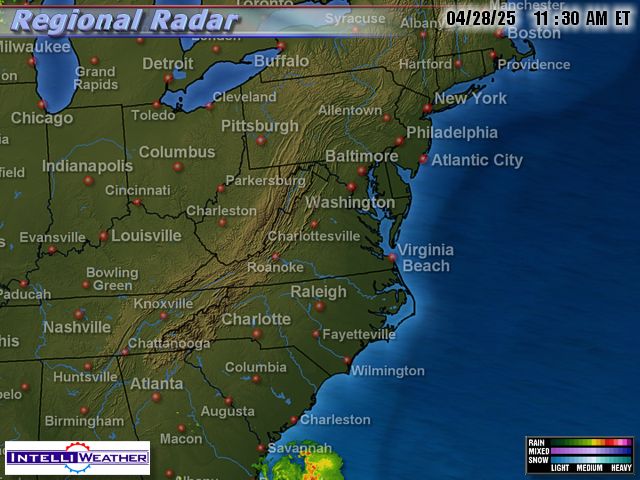
After some high clouds this morning, the Washington DC metro area is enjoying a beautiful late spring afternoon with sunny skies, northerly breezes, temperatures in the low 70s, and low humidity (dewpoints mainly in the mid 30s). As the high pressure currently dominating the Mid Atlantic region gradually slides eastward, temperatures will continue to warm and there is a chance for some much-needed showers tomorrow afternoon or evening.
Photo of yesterday's brilliant sunset by CapitalWeather.com photographer Kevin AmbroseTonight and Tomorrow

For tonight, increasing clouds will be accompanied by lows in the upper 50s in town to the low 50s in the colder 'burbs. Despite variably cloudy skies, tomorrow's highs should be near 80 with a 50% chance of showers by evening.
For the outlook Friday through the weekend, scroll on down to
Dan's earlier post.
Political Science

The movie
"An Inconvenient Truth" opens today in New York and Los Angeles and
around the country through June. This documentary on climate change is based heavily on a presentation developed by former Vice President Al Gore to spread the word about this important topic.
Given the high visibility of the main actor and the polarized state of current politics, reports indicate that the slime machine has already geared up to trash the messenger. Fox "News" weighed in with a
counter-documentary this past Sunday which featured only the very small minority of scientific skeptics. However, reporting from the Cannes Film Festival in today's NY Times, movie reviewer
A.O. Scott says,
Appearances to the contrary, Mr. Guggenheim's movie is not really about Al Gore. It consists mainly of a multimedia presentation on climate change that Mr. Gore has given many times over the last few years, interspersed with interviews and Mr. Gore's voice-over reflections on his life in and out of politics. His presence is, in some ways, a distraction, since it guarantees that "An Inconvenient Truth" will become fodder for the cynical, ideologically facile sniping that often passes for political discourse these days. But really, the idea that worrying about the effect of carbon-dioxide emissions on the world's climate makes you some kind of liberal kook is as tired as the image of Mr. Gore as a stiff, humorless speaker, someone to make fun of rather than take seriously.
The movie gets good marks for its scientific accuracy from the
RealClimate blog. Wonkette Ana Marie Cox has a
review of the D.C. premiere in the online version of Time Magazine.
In DC, the film will be shown beginning June 2 at the E Street and Georgetown theaters. It will also be playing in the metro area at the Bethesda Row, Gaithersburg Rio 18, Shirlington, and Cinema Arts Fairfax. The AP reports,
via USA Today, that the White House movie theater is not scheduling any showings.
The
book tied in to the movie won't be released until June 13, but it has already risen to number 129 (up from 240 yesterday) on the Amazon.com bestseller list.


 Yes, Virginia (and DC and Maryland, too), there was a sunrise this morning, but a pesky overcast kept temperatures suppressed until sunshine began to break out this afternoon. At Dulles, the temperature jumped from 66° to 71° to 75° from 1pm to 3pm. Humidity at the surface is also much more noticeable today, with dewpoints as much as 20° higher than yesterday.
 There is still a slight chance of a shower somewhere in the region through this evening. Otherwise, conditions will be dry and mild, but with increasing humidity and lows only down to the mid 60s. Tomorrow will be more summer-like with a mixture of sun and clouds and a 60% chance of showers or thunderstorms by evening; highs should be in the low 80s.

 Showers to the east of a strong storm nearly stationary over the Great Lakes began in the Washington metro area around 8am, but they have remained very light and spotty through most of the day. The official rainfall total is still under 0.10".
 The late-July-like sun through nearly clear skies and low humidity combined to bring a picture-perfect weather day to the Washington DC metro area. By 4pm, both major local airports had reached 77°, and dewpoints were all in the 40s. Dulles added another degree the following hour. Regional radar was bone-dry for hundreds of miles in all directions.
 The lead story on Comedy Central's Daily Show Monday was "The Weather Game." It was about the ads being run by Terre Haute, Indiana, TV station
  The unsettled weather pattern is continuing this afternoon in the Washington DC metro area as an Atlantic low pressure area heads toward New England. With more sun than clouds, however, temperatures have recovered nicely from yesterday's clammy 50s to the upper 60s or 70° by mid afternoon. Even Ocean City was up to 65° with an easterly breeze. After another dry day tomorrow, some rain is likely again by tomorrow night or Thursday.


 Posts
Posts